Subject: Wyoming
Period: 1891 (published)
Publication: Cram's Railway Atlas
Color: Printed Color
Size:
22 x 16.3 inches
55.9 x 41.4 cm
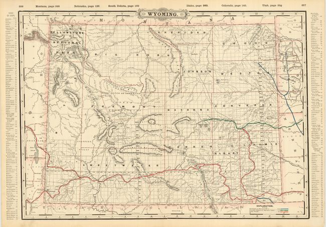
A large, double-page map from the Railway Atlas with colors detailing the routes of three railroad lines. Interesting look at Wyoming during this period of mineral exploration and development. The vast coal regions near Green River are noted. Filled with information and details including towns and settlements, roads and railroads, survey progress, and more. An index runs along both side borders. On the verso is the "Index to State Map of Wyoming" that details railroads, counties (13 plus the National Park Reservation), and a comprehensive list of towns with their population and index to map. Also on verso is a city map of Cincinnati.
References:
Condition: A+
Light soil in margins, still fine.