Subject: Oregon
Period: 1915 (dated)
Publication:
Color:
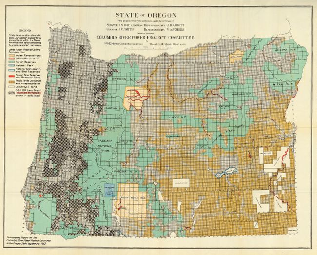
1) "State of Oregon." Map Prepared from Official Records under the Direction of...Majority Members Columbia River Power Project Committee by Wm. E. Morris… [and] …Theodore Rowland. Colorful large map on banknote paper with printed colors showing types of federal lands, including Indian reservations, forest preserves, etc. Land under state control is shown uncolored (32.8 x 26.5").
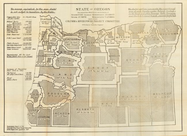
2) "State of Oregon." Map Prepared from Official Records under the Direction of...Majority Members Columbia River Power Project Committee by Wm. E. Morris Committee Engineer. A fascinating thematic map that gives the percentage of each county not being taxed per area within each county (B/W, 38 x 27.8").
Both maps folding as issued, with original printed envelope of the Oregon State Assembly as authorized by Senate Resolution Number Thirty-eight. Fine pair of historical maps relating to this huge power project on the Columbia River.
References:
Condition: A
Both are clean and bright. A few small splits at fold intersections, else fine. The former is on waxed bank note paper, the latter on bank note paper.