Catalog Archive
Auction 115, Lot 280

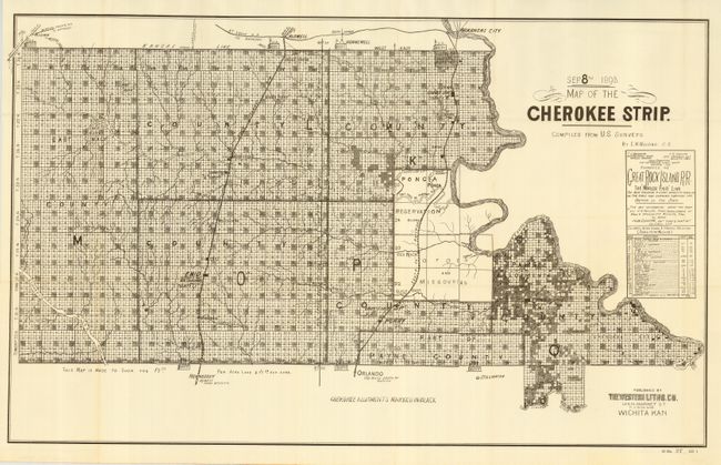
"Map of the Cherokee Strip Compiled from U.S. Surveys by E.W. Wiggins, C.E.", U.S. War Department

Subject: Oklahoma

Period: 1893 (dated)

Publication: HR Doc 27, 53rd Cong. 1st Sess.

Color: Black & White

Size:
32.3 x 19.8 inches
82 x 50.3 cm
Download High Resolution Image
(or just click on image to launch the Zoom viewer)

The Cherokee Outlet, about 12,000 square miles in present-day western Oklahoma, was purchased from the Cherokee in 1861. On September 16, 1893 it was opened for settlement with over 100,000 settlers braced on the opening lines. This map details the parcels available at $2.50 and $1.50 per acre. Locates the seven starting booths, plus the railroads, villages and towns, and topographical and watershed information. A remarkable document illustrating one of the greatest land rushes in history. Published by Western Litho. Co., Wichita, Kansas. A beautiful example of this desirable and historical map.

References:

Condition: A+

Folding, as issued. Mint condition.

Estimate: $200 - $300

Sold for: $400

Closed on 6/21/2006

Archived