Subject: Oklahoma
Period: 1889 (dated)
Publication: Sen. Doc. 78, 51st Cong., 1st Sess.
Color: Printed Color
Size:
31.5 x 23.5 inches
80 x 59.7 cm
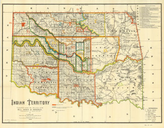
A colorful, detailed and informative map of present-day Oklahoma without its panhandle (Public Lands). Legends identify military reservations, Indian reservations, roads, trails, and railroads. Watershed and topography are well developed. Thirty-one different Indian lands are noted with information on pertinent treaties and Executive Orders, all keyed to the map. With handsome Victorian-style titling. The map was compiled under the direction of the Hon: John H. Oberly Commissioner of Indian Affairs. Attractive and large sheet lithographed by A. Hoen & Co of Baltimore.
References:
Condition: A+
Folding, as issued. Mint condition.