Catalog Archive
Auction 115, Lot 253

"Road Map of Southeastern Massachusetts Cape Cod, Nantucket and Martha's Vineyard. Reduced from Mass. Geological Survey",

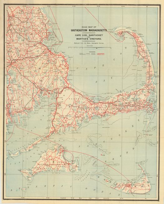
Subject: Massachusetts

Period: 1910 (circa)

Publication:

Color: Printed Color

Size:
17.3 x 22.3 inches
43.9 x 56.6 cm
Download High Resolution Image
(or just click on image to launch the Zoom viewer)

Scarce pocket map with cover titled "Road Map of Cape Cod Martha's Vineyard and Nantucket Price 15 Cents." Blue and white map with red and black overprinting to show railroads, best roads, other roads, and county boundaries. John F. Murphy, publisher, was active in the first decade of the 20th century, making this an early road map. Issued by the N.Y.N.H. & H.R.R. and Fall River Line Steamers and Rowes Wharf. A scarce issue.

References:

Condition: A

Map is near fine with only a few small fold intersection splits. Cover is lightly toned around edges.

Estimate: $150 - $250

Sold for: $180

Closed on 6/21/2006

Archived