Subject: Florida
Period: 1846 (dated)
Publication:
Color: Black & White
Size:
40 x 41.5 inches
101.6 x 105.4 cm
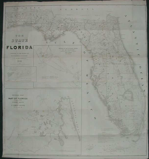
A very large and comprehensive map of Florida showing the status of Public Land Surveys, rivers, lakes, coastal islands, towns, army posts, trails etc. Inset maps: "Key West as surveyed February 1829"; "Mouths of Swanee R. and Cedar Keys showing the Western terminus of a proposed railroad"; and "A General Map of part of Florida included between Cedar Keys and St. John's River." This is an incredible chart that is filled with detail. Drawn by J. Goldsborough Bruff and finely engraved by D. McClelland of the Topographical Engineers. An early and most desirable Florida issue.
References:
Condition: B
Nice impression. Issued folding, now pressed and backed with archival tissue. Close trimmed at left side with slight loss to neatline at bottom with paper laid in,. A few spots and some light offsetting in blank areas, else very good.