Subject: United States - Northwestern
Period: 1852 (dated)
Publication: Schoolcraft's Information Respecting the History... Indian Tribes…
Color: Hand Color
Size:
10.3 x 8 inches
26.2 x 20.3 cm
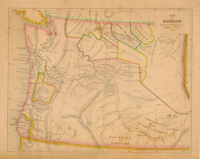
Great map of Oregon Territory is filled with place names and information. Area extends to the Rocky Mountains beyond Flathead Lake. The regions are divided and colored to indicate Indian Tribe regions. Mt. St. Helen's, Fort Nisqually, Stillicim, Mt. Rainer, Astoria and across the Columbia the settlement of Bernie's, Portland, Salem, Oregon City, and many more are named. The Olympic Peninsula is completely blank except for a range of mountains, wildly placed in a straight line down the center of the peninsula. There is good detail of major rivers. The Emigrant Road follows the Salmon River to Fort Boise, then deviates west to join the Columbia River at Agency House. Engraved by W. Williams.
References:
Condition: B
Nice example with even ivory toning, some scattered foxing, spots mostly at lower right. Professionally encapsulated in Mylar.