Catalog Archive
Auction 115, Lot 199

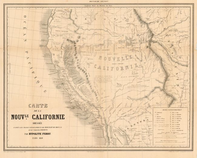
"Carte de la Nouvle. Californie Dressee…Geographiques de Mr. Duflot de Mofras et du Colonel Fremont", Ferry, Hypolite

Subject: United States - Western

Period: 1850 (dated)

Publication: Description de la Nouvelle Californie geographique

Color: Black & White

Size:
19.5 x 15.3 inches
49.5 x 38.9 cm
Download High Resolution Image
(or just click on image to launch the Zoom viewer)

Based largely on the work of De Mofras and Fremont, this map adds the large gold region of California, shown by a shaded area. The map extends to east of the Rockies and the continental divide, south into Sonora and part of Baja, and well into Oregon Territory to the west. Many place names and Indian regions are noted. Wheat says this map "was about as up-to-date as it could have been in early 1850." Charming vignettes of Indians and wild animals are scattered about the map. A rather scarce issue.

References: Wheat (TMW) 673; Wheat (Gold) 155

Condition: B

Very good with just a little toning along one fold and a couple small spots. Professionally encapsulated in Mylar.

Estimate: $500 - $700

Sold for: $375

Closed on 6/21/2006

Archived