Subject: Colonial Southeast
Period: 1764 (published)
Publication: Petit Atlas Maritime
Color: Hand Color
Size:
14 x 9 inches
35.6 x 22.9 cm
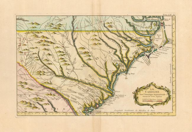
This wonderful map shows a rather compressed rendition of the coastline of both Carolinas, from Albemarle Sound (Baye Albermarle) and Pamlico Sound (Baye de Panticoe) at the north to St. Helene Sound and Augusta, Georgia to the south. Along the way are many recognizable settlements, rivers and other landmarks, including: Cap Hatteras, Cap Fear, Charles Town, New Bern, the Little and Grande Pedee Rivers, George Town and Edisto Island. The map shows many rivers, and several roads to the interior Cherokee villages. A fine pre-Revolutionary War map of the coastal Carolinas. Decorative cartouche.
References: Cumming (SE) 342, Bellin 1764A, color plate 21
Condition: A
Dark impression with fine hand coloring on a full sheet of hand laid paper with wide margins and large watermark. Hint of centerfold toning, still very good.