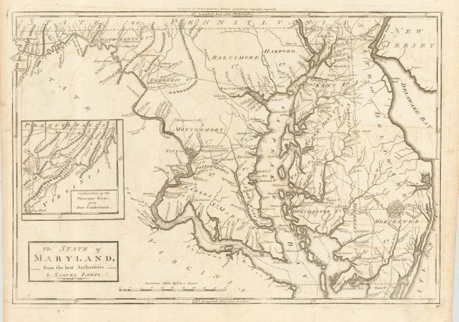
Subject: Maryland & Delaware
Period: 1795 (published)
Publication: Carey's American Edition of Guthrie's Geography Improved
Color: Black & White
Size:
16.5 x 11.3 inches
41.9 x 28.7 cm
First edition of the first American produced atlas map of Maryland. Details include towns and villages, roads, and watershed of the state. The City of Washington is shown as a block plan. The western boundary line is shown extending north from the course of the Potomac. Inset at left: "Continuation of the Potowmac River, from Fort Cumberland". Distance scale in "American Miles." Engraved by William Barker who also worked on other maps in Carey's American Atlas, where this map also appeared. A nice example on sound paper with full margins.
References: Wheat & Brun 510, state 1
Condition: B
Light offsetting and two tiny wormholes visible when held to light, else very good with original margins. Professionally encapsulated in archival Mylar.