Catalog Archive
Auction 115, Lot 120

"[Lot of 2] Karte von J. Palliser's Expedition zur Erforschung der Rocky Mountains Britisch-Nord-Amerika, 1858. [and] Karte der Red River Expedition in Britisch Nord-Amerika unter Gladman, Hind, Napier, Dawson, &c. 1857 und 1858.", Perthes, Justus
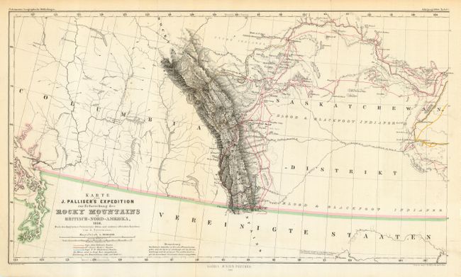
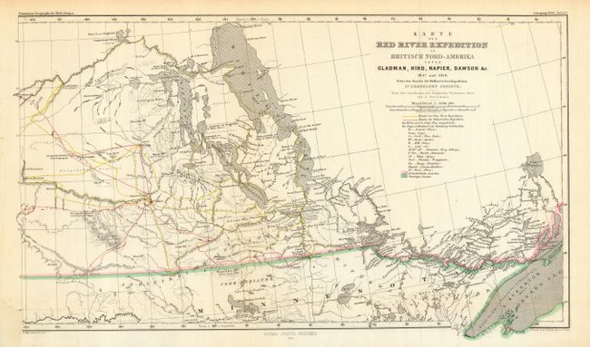
Subject: Canada

Period: 1860 (published)

Publication: Petermann's Geographical Magazine

Color: Hand Color

Size:
17.5 x 9.5 inches
44.5 x 24.1 cm
Download High Resolution Image
(or just click on image to launch the Zoom viewer)

Very detailed charts that fit together to form a contiguous illustration from Victoria, BC, to Lake Nipigon. In size, they are about two-thirds of Palliser's large and virtually unobtainable map and were published about three years earlier. The western map shows the disputed boundary claim vicinity of the San Juan Islands and the route of Palliser. The eastern sheet shows the routes of the named explorers and would have a significant impact on the settlement of south central Canada. Finely engraved with mountains shown via hachure. Engraved line and hand coloring delineates the routes of Capt. John Palliser, Dr. James Hector, Capt. T.W. Blankiston, and the Red River expedition. Legend locates creeks, camps, portages, rapids, and more.

References:

Condition: A

Pressed and backed with archival tissue. With original hand coloring in outline. Hint of toning in former along a fold, still very good.

Estimate: $200 - $300

Sold for: $250

Closed on 6/21/2006

Archived