Subject: North America
Period: 1788 (published)
Publication: Allgemeiner grosser atlas…
Color: Hand Color
Size:
23 x 19.8 inches
58.4 x 50.3 cm
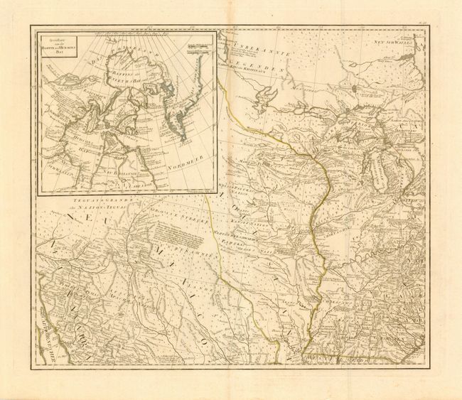
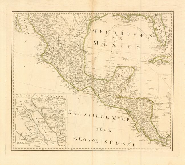
This lot contains two sheets from the scarce 4-sheet Austrian map that was based on the important Bowen & Gibson map of North America and the West Indies (Sayer & Bennett 1783 edition) updated to include the surveys of Governor Thomas Pownall. This lot includes the two untitled western sheets. The southwest sheet covers Mexico, Central America, the Gulf coast, Florida and part of Cuba. At lower left is a large inset of the Gulf of California illustrating Father Kino's discoveries in 1698-1701. The northwest sheet extends north to include New Mexico and the Great Lakes reaching as far east as Lake Erie. It also contains a large inset detailing the Baffin & Hudson Bays with a depiction of the Northwest Passage according to Admiral de Font. Both are beautifully engraved with excellent detail of roads, trails, settlements, Indian nations and notations of various explorations. Engraved on two separate, large folio, sheets (each map approximately 23 x 20") with very wide margins.
References: McCorkle #788.6; Phillips (A) 694-36a-d; cf. Stevens & Tree 49.
Condition: A
Fine, dark impression with original hand coloring in outline. Thick hand laid paper with very wide, original margins.