Catalog Archive
Auction 114, Lot 80

"Nieuwe Kaart van het Westelykste Deel der Weereld, dienende tot aanwyzing van de Scheepstogten der Nederlanderen Naar Westindie…", Tirion, Isaac

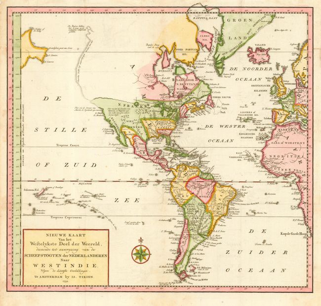
Subject: Western Hemisphere

Period: 1754 (dated)

Publication:

Color: Hand Color

Size:
14.3 x 13.3 inches
36.3 x 33.8 cm
Download High Resolution Image
(or just click on image to launch the Zoom viewer)

An attractive map of the Americas that also includes a good bit of western Europe and Africa. The map displays a great River of the West through North America, beginning at the Great Lakes and emptying into the Pacific at about 50 deg. N. latitude. The entire western part of North America is virtually blank. The northwest coastline is delineated by a dotted line terminating with a notation concerning the Russian explorations in 1743 in the region of Alaska. Simple title cartouche and nice compass rose adorn the map.

References:

Condition: A

Issued folding, now pressed. Bit of faint uneven toning mostly in margins.

Estimate: $350 - $400

Sold for: $250

Closed on 3/1/2006

Archived