Subject: Western Hemisphere
Period: 1641 (dated)
Publication: Newer Atlas
Color: Hand Color
Size:
19.5 x 14.8 inches
49.5 x 37.6 cm
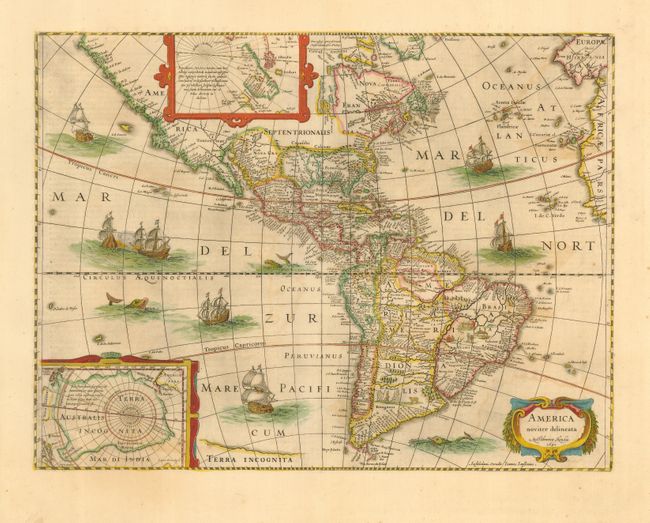
Beautiful map of the Americas originally issued by Jodocus Hondius and derived from two earlier maps by Blaeu. The North Pole depicts Frobisher's theory of the Northwest Passage and the South Pole shows the long-held notion of the mythical southern continent. North America retains the peninsular California and the East Coast is beginning to take shape, although it still lacks detail in the mid-Atlantic region. In the Southwest the famous seven cities of Cibola appear on the banks of a large lake. In South America, there is a large inland sea and two engraved scenes, one of which details a cannibalistic feast. Two stylized insets of the two polar regions are enclosed in strapwork cartouches. The map is richly ornamented with a strapwork title cartouche, fleets of ships and sea monsters. Jansson's imprint appears below the cartouche. German text on verso.
References: Burden #192; Goss #27; Tooley (America) plt. 172.
Condition: B
Nice impression and original color with a bit of offsetting.