Subject: Western Hemisphere
Period: 1630-36 (published)
Publication: Atlas sive Cosmographicae
Color: Black & White
Size:
9.5 x 7 inches
24.1 x 17.8 cm
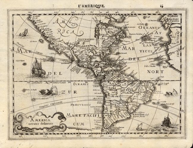
First state of this very uncommon map from the reduced size series of the Mercator - Hondius atlas. The cartography is classic Hondius with the inaccurate mid-Atlantic coastline of North America, and the sweeping northwest coastline. The fictitious islands of Frisland and Brasil are located in the north Atlantic. Hudson Bay is left open to the west for the possibility of a northwest passage to Asia. Page number 19 in top margin, French text on verso. Very crisp impression and decorated with a strapwork cartouche, ships, boats and sea monsters. This first edition sheet was published in either 1630 or 1636.
References: Burden #224.
Condition: B
Very nice impression on thick hand laid paper with large watermark. Expert repair off east coast of South America with slight loss to a little text with no facsimile. Otherwise very good.