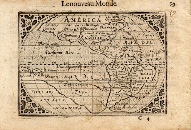
Subject: Western Hemisphere
Period: 1602 (published)
Publication: Tabularum Geographicarum Contractarum
Color: Black & White
Size:
4.7 x 3.2 inches
11.9 x 8.1 cm
This is the 1602 French edition of this charming miniature map that was based on the 1587 folio map by Abraham Ortelius. A notation in North America notes its discovery by Christopher Columbus in 1492. The only place names noted in North America are Norombega, Granada, and Marata, all being mythical. This map has a convoluted publishing history and it has been attributed to both Cornelis Claesz and Petrus Bertius. It made its appearance in a number of works starting with Claesz' work criticizing the Spanish for their treatment of the Indians. It then appeared in Bertius' revision of Langenes' pocket atlas. Claesz was the publisher for both these works. The title appears above the top border.
References: Burden #92.
Condition: B
Crisp impression with full margins. Some light soiling in margins and a little at lower center of map, else very good.