Catalog Archive
Auction 114, Lot 601

"Tabula Superioris Indiae & Tartariae maioris [title on verso]", Fries, Lorenz

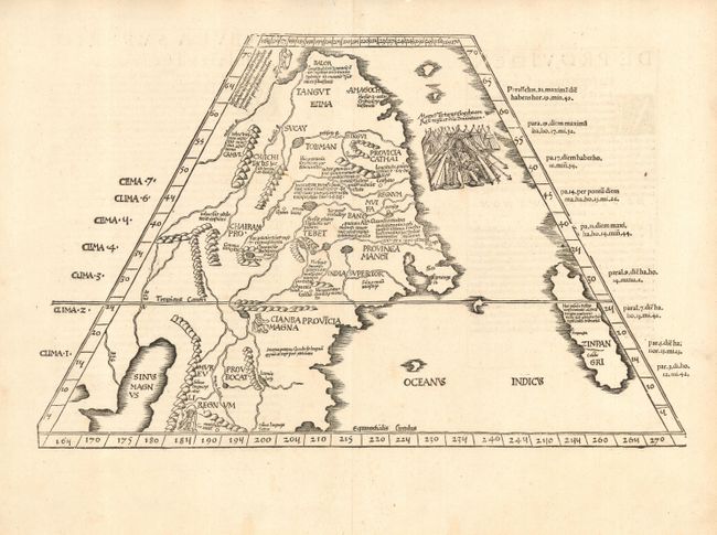
Subject: China, Korea & Japan

Period: 1541 (published)

Publication: Claudii Ptolemaei Alexandrini Geographicae…

Color: Black & White

Size:
18 x 11.5 inches
45.7 x 29.2 cm
Download High Resolution Image
(or just click on image to launch the Zoom viewer)

This important map is the first printed map to focus on China and Japan. Presented on a trapezoidal projection in Ptolemaic format, the map extends well beyond the geography described by Ptolemy and draws from the report of Marco Polo. Japan (Zinpangri) is a north-south oriented island. Several regions in China are noted with numerous rivers and a huge lake labeled Sinis Magnus. A vignette of the king of Tartary embellishes the map.

References: Mickwitz & Miekkavaara (Nordenskiold) # 211-43; Walter plt.3.

Condition: A

Good impression. Couple of professional repairs in wide margins, well away from map.

Estimate: $3,000 - $3,500

Sold for: $3,000

Closed on 3/1/2006

Archived