Catalog Archive
Auction 114, Lot 495

"Carte Ancienne et Moderne des Differents Etats et Pais Situez au Long du Danube…", Chatelain, Henry Abraham
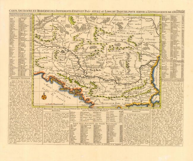
Subject: Balkans

Period: 1708 (circa)

Publication: Atlas Historique

Color: Hand Color

Size:
18 x 14 inches
45.7 x 35.6 cm
Download High Resolution Image
(or just click on image to launch the Zoom viewer)

Handsome map of the Balkans showing the various historical regions with explanatory text and tables on three sides. The map focuses on the Danube valley, which is the most important hydrographic feature of the region. The Balkan Peninsula was a politically and economically important region situated along the overland route from the Mediterranean to the Black Sea and between Europe and Asia. The Balkans were once Roman provinces and then a part of the Byzantine Empire until it was conquered by the Ottoman Turks.

References:

Condition: A

Estimate: $190 - $230

Sold for: $190

Closed on 3/1/2006

Archived