Catalog Archive
Auction 114, Lot 461

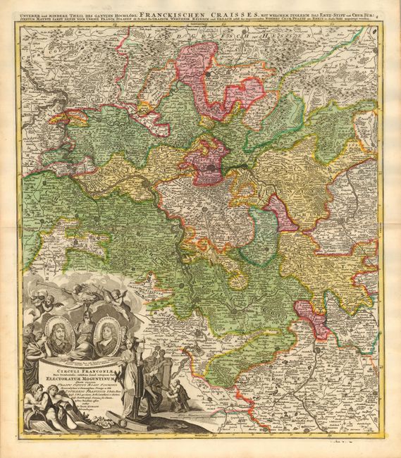
"Circuli Franconiae Pars Occidentalis, exhibens simul integrum fere Electoratum Moguntinum", Homann, Johann Baptist

Subject: Germany

Period: 1716 (published)

Publication: Grosser Atlas

Color: Hand Color

Size:
19 x 21.7 inches
48.3 x 55.1 cm
Download High Resolution Image
(or just click on image to launch the Zoom viewer)

A striking regional map of Germany, centered on Frankfurt, Darmstatt, Maintz and Heidelberg, and also shows Stuttgart, Heilbron, Wertheim, and Coblentz. The map is centered on Die Berg Strass or mountain route from Darmstadt to Heidelberg, a popular tourist tour today - via autobahn. Remarkable detail; roads, rivers, lakes, mountains, towns, fortified cities are shown. The large decorative cartouche has portraits of Joannes Philip and Lotharius Franciscus and many allegorical figures.

References:

Condition: A+

Superb impression and original color.

Estimate: $300 - $350

Sold for: $325

Closed on 3/1/2006

Archived