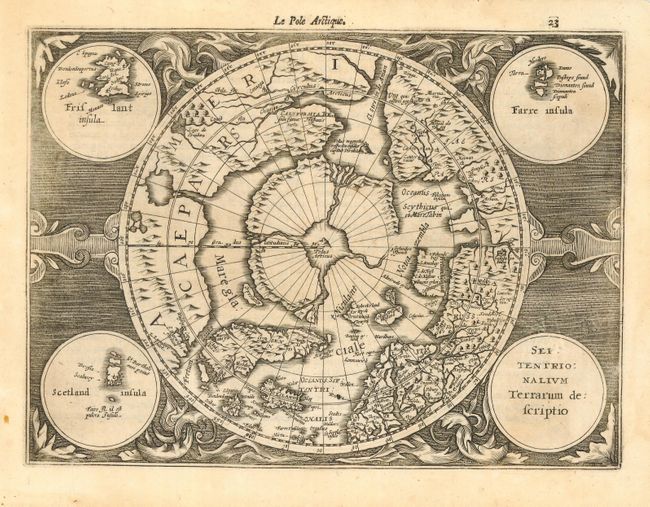
Subject: North Pole
Period: 1635 (circa)
Publication: Atlas sive Cosmographicae
Color: Black & White
Size:
9.7 x 7.2 inches
24.6 x 18.3 cm
First state of this reduced version of Mercator's famous map of the North Pole. The hemisphere is surrounded by a finely engraved design with four round insets in each corner. These contain the title, the Faeroe Isles, the Shetland Isles, and the mythical island of Frisland. The North Pole is shown according to legend as a large rock in a giant whirlpool surrounded by four islands that are separated by rivers. The magnetic pole is depicted as an island in the Strait of Anian. An elaborate river network and large bay is shown in the extreme northwest part of North America. French text on verso with Le Pole Arctique and page number 23 at top right above map.
References: Burden #225.
Condition: B
Fine impression. Professional and near invisible restoration of a small hole in title cartouche and some worming in blank margins.