Catalog Archive
Auction 114, Lot 435
"[Lot of 2] Nieuwe Kaart der platte Grond van de Stad Parys… [together with] Nieuwe kaart van Parys en Versailles…", Tirion, Isaac
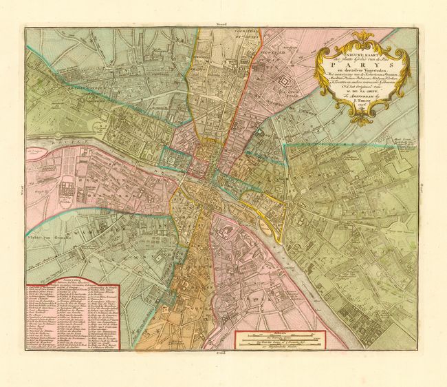
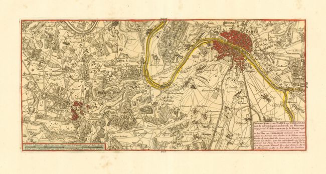
Subject: France, Paris
Period: 1756 (dated)
Publication: Nieuwe en Beknopte Hand Atlas
Color: Hand Color
Size:
14.7 x 12 inches
37.3 x 30.5 cm
Download High Resolution Image
(or just click on image to launch the Zoom viewer)
(or just click on image to launch the Zoom viewer)