Subject: England & Wales
Period: 1637 (published)
Publication: Camden's Britannia
Color: Hand Color
Size:
12.5 x 10.8 inches
31.8 x 27.4 cm
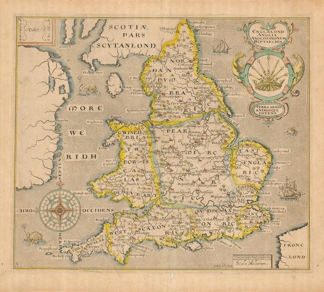
Very graphic map of England and Wales depicting the traditional Anglo Saxon kingdoms. This is the earliest obtainable map of England and Wales that is affordable for most collectors. Moreland & Bannister say collectors have 'unjustly neglected' this map. First published in 1607 in the sixth edition of Camden's Britannia, the map is derived from William Rogers’ map of 1606. The place names have been transliterated into so-called Anglo-Saxon script, with a key at upper left that aids in the translation of letters. The large and ornate title cartouche features the seven-scepter symbol of the Heptarchy. The map is further decorated with a superb compass rose, two ships and three sea monsters. Blank verso. This is the 1637 edition with the numeral one added at lower left. Drawn and engraved by William Hole.
References: Shirley (BI) #280; Moreland & Bannister p. 212.
Condition: B
Nice impression on hand laid paper with large watermark and full margins. Color a little faded, small hole in lower margin, else very good.