Subject: Caribbean and Atlantic
Period: 1835-36 (dated)
Publication:
Color: Hand Color
Size:
15.5 x 12.5 inches
39.4 x 31.8 cm
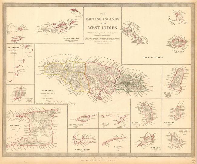
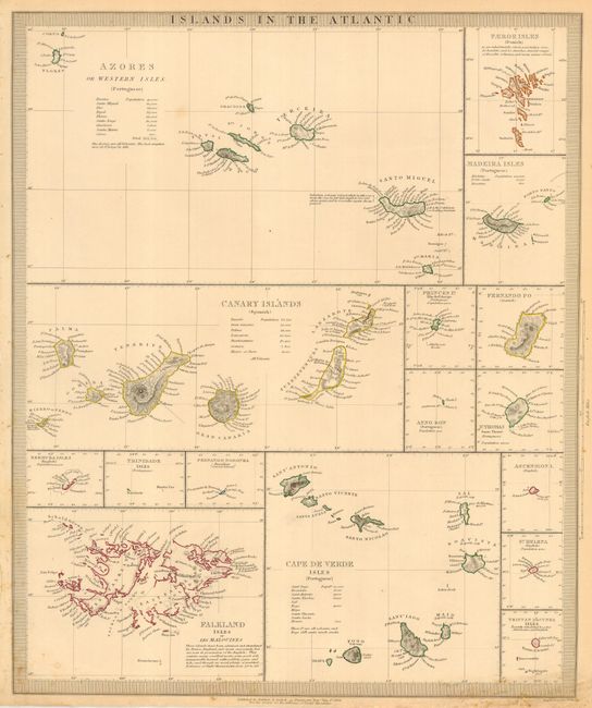
Pair of finely detailed steel engravings, each depicting several islands in the region. First is centered on Jamaica with 14 insets of individual islands or island groups in the Lesser Antilles, with their dates of discovery or British settlement. The additional charts are of the Leeward Islands, the Virgin Islands, Grenadines, Granada, Trinidad, New Providence, Anguila, Dominica, St. Vincent, St. Lucie, Barbados, Tobago, Roatan, and Grand Cayman. Second map features a group of 16 charts of the various islands. The larger maps feature the Azores, the Canary Islands, the Cape de Verde Isles, and the Falklands. The others show Bermuda, St. Thomas, St. Helena, Trinidad, plus the Faeroe, Madeira, Princes, Fernando Po, Anno Bon, Fernando Noronha, Ascension, and Tristan d'Acunha Isles. Published by Baldwin & Cradock. These are among the few 19th century maps showing some of these islands with such level of detail.
References:
Condition: B
Minor soil in borders.