Subject: Gulf of Mexico and Caribbean
Period: 1671 (published)
Publication: America
Color: Hand Color
Size:
14 x 11.3 inches
35.6 x 28.7 cm
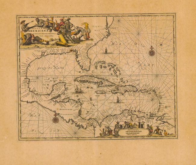
Outstanding map of the West Indies that also incorporates the eastern coast of North America from the Chesapeake through the Gulf of Mexico, Central America and the northern coast of South America. Cartographically based on Hessel Gerritsz' chart of 1631 and Blaeu's map of 1634. Scenic title cartouche fills the North American continent and an equally graphic scale of miles cartouche fills the interior of South America, each surrounded by Native Americans and European merchants. The seas are embellished with rhumb lines, ships and compass roses.
References:
Condition: B
Nice impression and good margins. Toned with a few spots and faded color, else very good. Minor printer's crease along centerfold. Remnants of hinges and some minor defects in blank margins.