Subject: Southwest U. S., Texas, Mexico & Central America
Period: 1843 (circa)
Publication: A New General Atlas of the World
Color: Hand Color
Size:
10 x 8 inches
25.4 x 20.3 cm
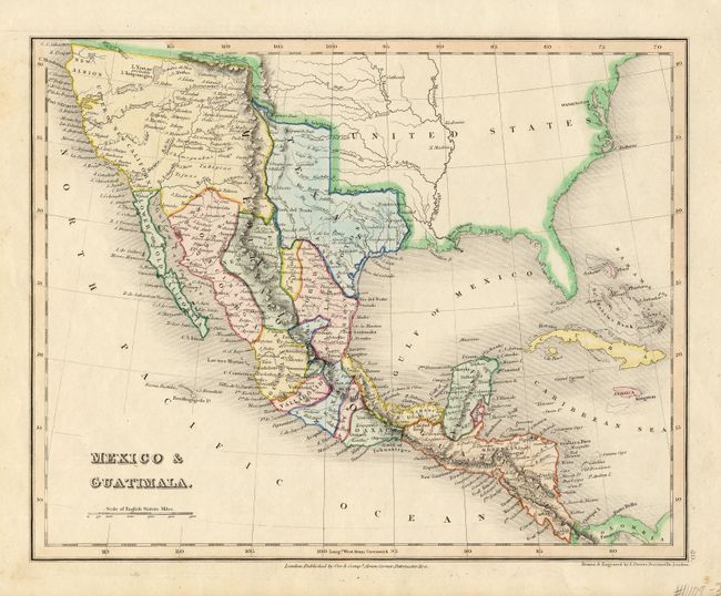
A beautifully colored map that features the Independent Republic of Texas with the long stovepipe configuration extending to about the 40th parallel. The map shows all of Upper or New California naming San Francisco, San Luis Obispo, Santa Barbara, San Diego, etc. The Baja peninsula is Lower or Old California. The rivers Timpanogas and San Buenaventura run across the unnamed Great Basin to the Pacific Ocean. The map locates many Indian tribes, forts and early settlements. A very well engraved map with fine original coloring.
References:
Condition: A+
Fine coloring and impression. Full margins. A little spotting in margins, map fine.