Subject: Wyoming
Period: 1883 (published)
Publication: HR Misc Doc. 47th Cong., 1st Session.
Color: Printed Color
Size:
28.4 x 32 inches
72.1 x 81.3 cm
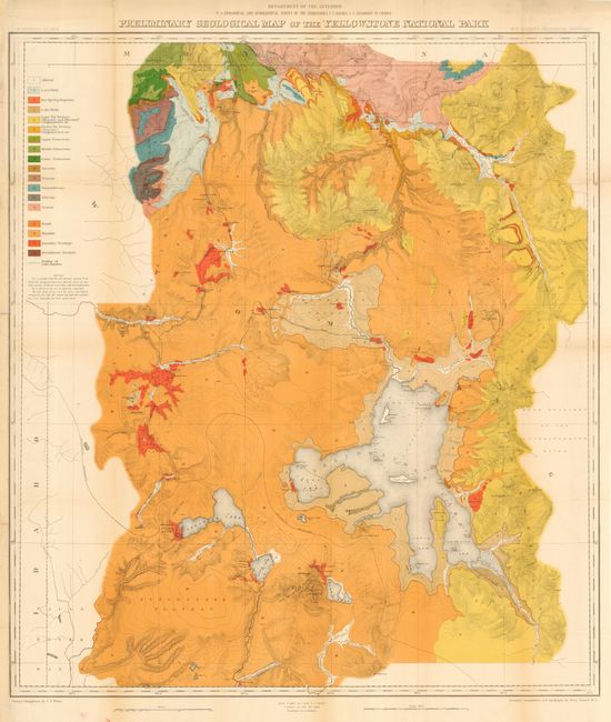
Although describing conditions surveyed in 1878, it was not published until 1883 in Hayden's 12th Annual Report. The map is one of two relating to Yellowstone (one topographical, and this, geological) that Wheat felt raised the cartography of Yellowstone to a "vastly higher level…and must be regarded as the first modern maps of the Park." It is a spectacular, early chromolithograph map of Yellowstone printed in 18 colors by the notable firm of Julius Bien. W.H. Holmes was the Geological Assistant to Hayden. Although 3 or 4 reports had been written previously about the park, Holmes felt that there was still much more ground to be covered and said that he could have spent years, instead of the just the summer of 1878, to properly explore the geology of the park's 3,400 square miles. Very detailed on a scale of 1 inch = 2 miles and filled with contour lines at 100 feet increments. The color key defines the geologic formations.
References: Wheat (TMW) 1296.
Condition: A
Issued folding, now pressed and backed with archival tissue. Light toning along fold at left, still very good with bright coloring and fine impression.