Subject: Wyoming
Period: 1877 (dated)
Publication: HR Misc Doc. 47th Cong., 1st Session
Color: Printed Color
Size:
33.3 x 22.8 inches
84.6 x 57.9 cm
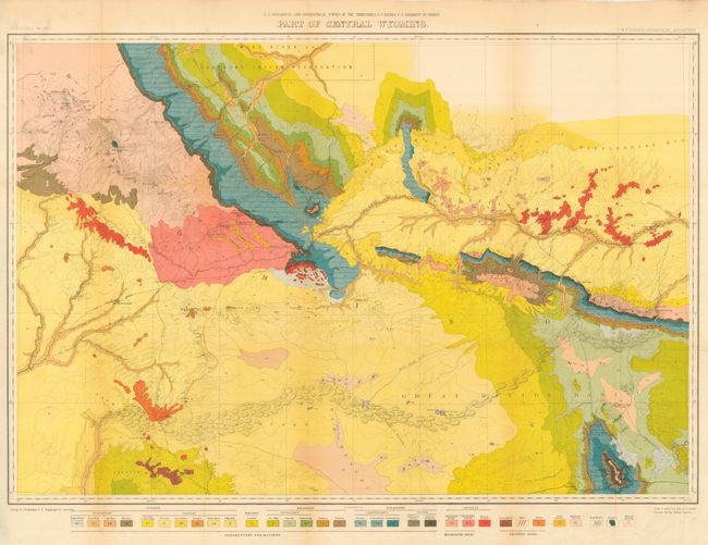
One of six distinctive maps of the Wyoming group from this important early survey; it displays the full course of the Sweetwater River, South Pass, etc. and depicts trails throughout the region. Wheat draws attention to the map's value to students of the Fur Trade and overland immigration routes. The map was published in Hayden's 12th Annual Report, published in 1883. With this publication, the maps finally adopted the contour system (instead of hachure). Remarkable detail is shown with contour intervals at 200 feet and a scale of 4 miles = 1 inch. The map extends from part of the Wind River Reservation south to Rawlins. Old wagon roads, trails and the Union Pacific Railroad are featured. A color and pattern code at the bottom provides the key to the 32 different geologic types.
References: Wheat (TMW) #1296.
Condition: A
A near fine example that is pressed and backed with archival tissue. Short tear or two in margin well away from image.