Subject: Wisconsin
Period: 1839 (published)
Publication: Sen Doc 140, 26th Congress 1st Session
Color: Black & White
Size:
24 x 35 inches
61 x 88.9 cm
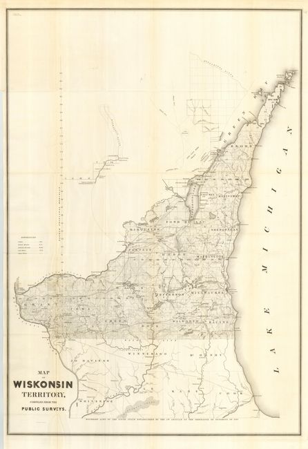
This is a great, early map of Wisconsin showing the surveyed part between the Illinois border and the Wisconsin River north to show all of the Door Peninsula. It was compiled from the surveys of Capt. Thomas Jefferson Cram and accompanied his "Report from the Secretary of War…[concerning] the internal improvements in the Territory of Wisconsin…" A skeleton line representing the Wisconsin River continues above the main map and locates a few settlements including Grignon's Trading Post, Whitney's Mill, Bloomer & Co., etc. Illinois is referred to as the "Fifth State Established by the 5th Article of the Ordinance of Congress of 1787." West of Fort Howard is a 500,000 acre tract with the Oneida Indians occupying a portion. Filled with details and place names including many early towns and villages. Large, early and desirable map for the Wisconsin collector.
References: Claussen & Friis #329.
Condition: A
Folding, as issued. Trace of toning along some folds.