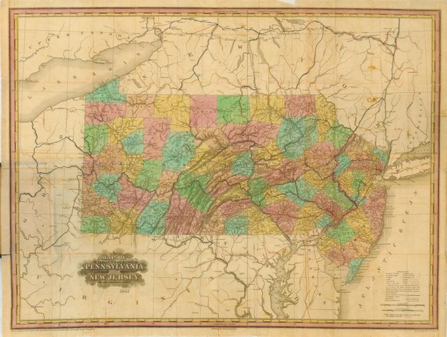
Subject: Pennsylvania & New Jersey
Period: 1841 (dated)
Publication:
Color: Hand Color
Size:
27.3 x 20 inches
69.3 x 50.8 cm
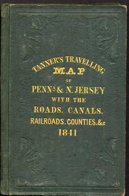
This scarce pocket map folds into green gilt-stamped covers with title "Tanner's Travelling Map of Penna. & N. Jersey with the Roads, Canals, Railroads, Counties. &c. 1841." Boards measure 3.8 x 6 inches. The map is printed on fine bank note paper with beautiful original full hand coloring. Locates a surprising number of early railroads. The legend locates state capitals, county towns, villages, mills, iron works, forts, post offices, battle grounds, roads, ferries, water falls, and more. Main roads have mileage noted between segments. A most desirable map that is the pocket map edition of the map from the scarce American Atlas. Engraved by H.S. Tanner and Associates.
References: cf Phillips (Maps) p. 681.
Condition: B
Covers lightly rubbed. The map is bright but with several folds reinforced on verso to support a brittle fold. A little offsetting visible in blank regions surrounding map and a couple spots.