Catalog Archive
Auction 114, Lot 267

"Pennsylvania Drawn from the best authorities by Cyrus Harris", Morse, Jedidiah (Rev.)

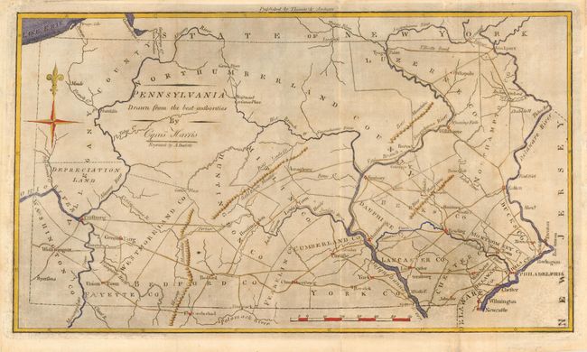
Subject: Pennsylvania

Period: 1796 (circa)

Publication: The American Universal Geography, 3rd edition

Color: Hand Color

Size:
13 x 7.5 inches
33 x 19.1 cm
Download High Resolution Image
(or just click on image to launch the Zoom viewer)

This is an early American map of the state of Pennsylvania. It shows early county boundaries, cities, towns, roads, portages and rivers. A few mountain ranges are sketchily depicted but there is little other topographical information. The Erie Triangle is shown as a part of New York. There is a compass rose at upper left and longitude is measured from Philadelphia. The map was engraved by Amos Doolittle.

References: Wheat & Brun #446.

Condition: B

There is printer's ink residue covering the entire map. There has been an attempt to clean this residue resulting in abrasion of some of the engraving with a few lines of facsimile.

Estimate: $180 - $220

Sold for: $130

Closed on 3/1/2006

Archived