Subject: Oklahoma
Period: 1885 (dated)
Publication: Senate Ex. Doc 50, 48th Cong., 2nd Session
Color: Printed Color
Size:
32.5 x 24 inches
82.6 x 61 cm
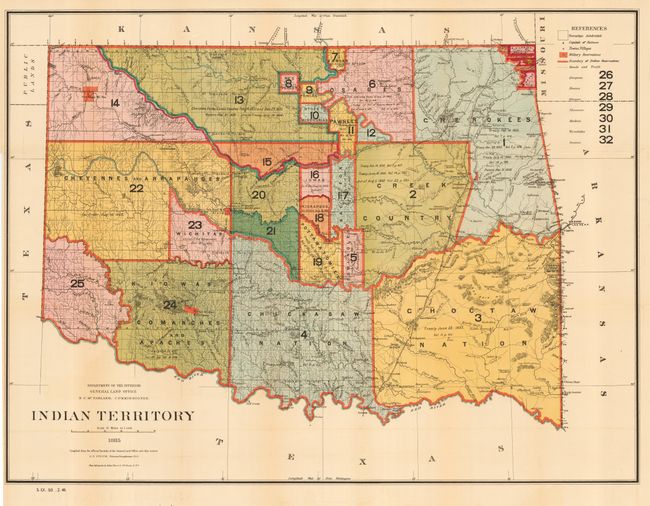
A most interesting and detailed map reflecting the status of lands allocated to various tribes (color-coded). Indian removals from 'home lands' began as early as 1817, and in the years following many of the principal Eastern Indian tribes were relocated to the region with the Five Civilized Tribes having formed the nucleus of an organized government. By 1885, however, representatives of some fifty tribes had settled on lands once promised to the original five. This map reflects many of these allocations and provides some data on the pertinent treaties involved. Does not include the panhandle, which by this time are Public Lands. Drawn by G. P. Strum.
References:
Condition: A
Lovely impression and fine color. Issued folding, now backed with archival tissue. Light toning at some folds, still very good for this sheet.