Subject: Missouri
Period: 1837-52 (dated)
Publication:
Color: Black & White
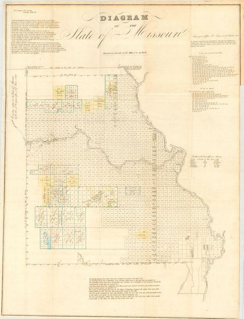
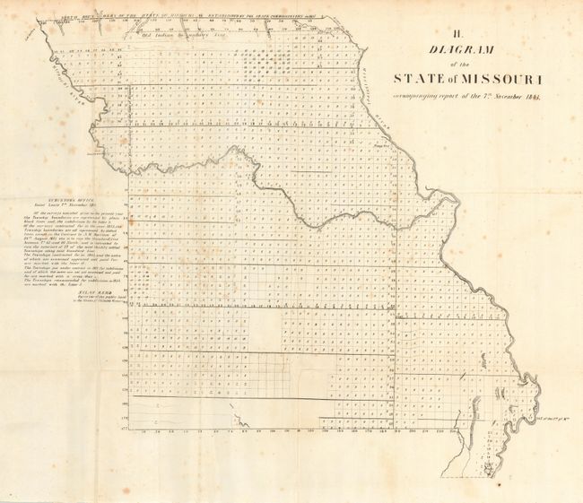
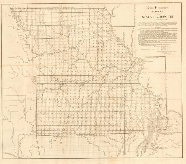
Set of three early state maps show the progression of surveying in the state of Missouri. 1) "Diagram of the State of Missouri," 1837, with some original color, 19 x 25 inches. 2) H. "Diagram of the State of Missouri accompanying report of the 7th November 1843," is a simple plan surveyed by Silas Reed, 21 x 18.5 inches. 3) E and F (combined) "Diagram of the State of Missouri accompanying report of the 30th October 1852," includes additional information outside Missouri showing the extent of the Osage Reservation, 22 x 19 inches.
References:
Condition: A
All folding, as issued. The 1837 & 1852 sheets are generally in very good condition. The 1843 sheet has a little scattered foxing, else very good.