Subject: Hawaii
Period: 1915 (dated)
Publication:
Color: Printed Color
Size:
32.8 x 21.8 inches
83.3 x 55.4 cm
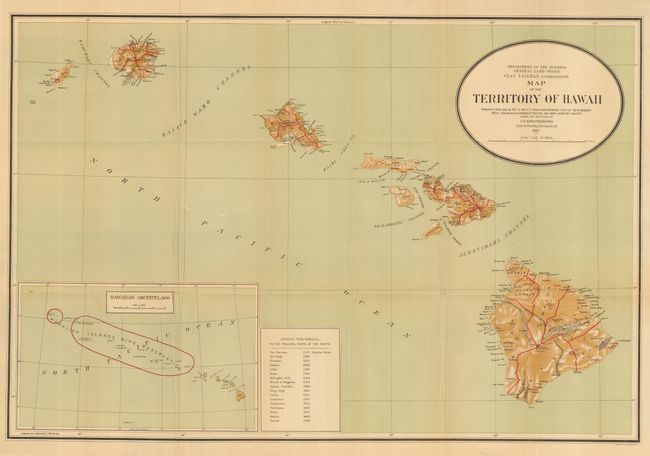
A large and colorful map that was "compiled from data on file in the U.S. Coast and Geodetic Survey: Hydrographic Office: Hawaiian Government Surveys, and other authentic sources under the direction of I. P. Berthrong chief of drafting division." Published under the direction of the commissioner Clay Tallman. Large inset (12.5 x 7.5") at lower left gives a wider view of the entire archipelago and notes in red the Hawaiian Islands Bird Reservation. Table gives the distances to the principle ports in the Pacific Ocean from Honolulu. Good detail on a scale of 1 inch = 12 miles.
References:
Condition: A
Bright color and fine impression. Folding, as issued. Short tear at binding trim that enters border, closed on verso with archival tape, a few fold intersection splits, else fine.