Subject: District of Columbia
Period: 1891 (published)
Publication:
Color: Printed Color
Size:
27.5 x 28 inches
69.9 x 71.1 cm
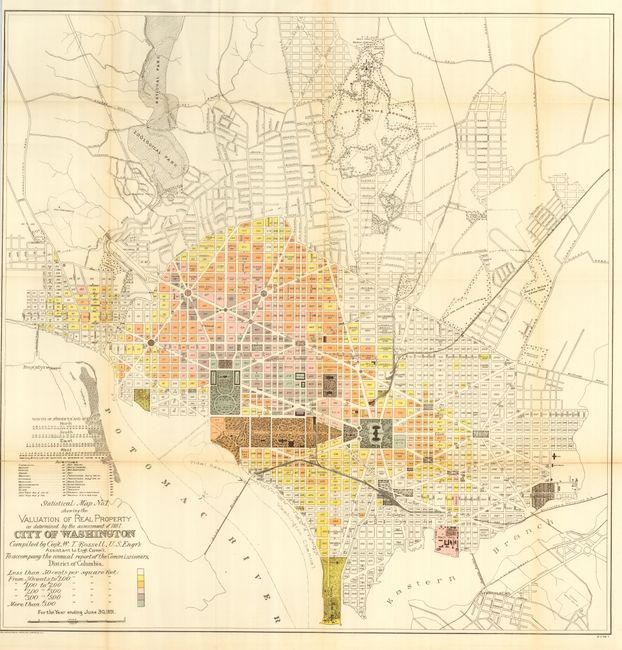
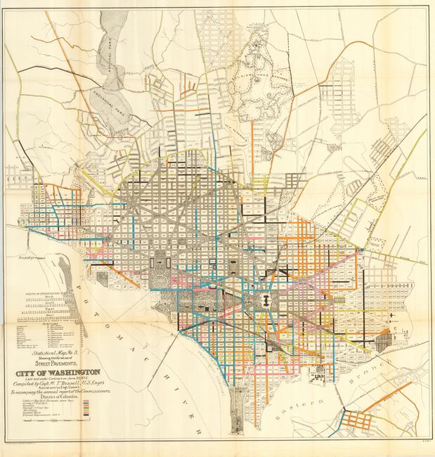
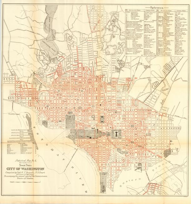
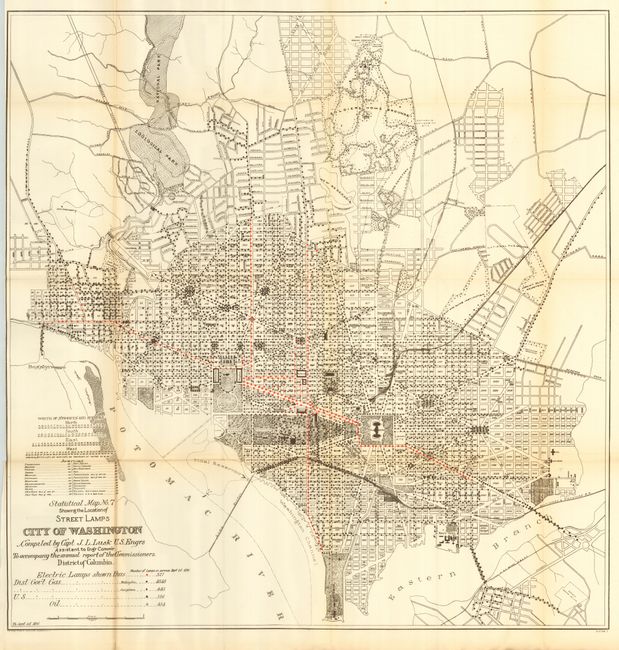
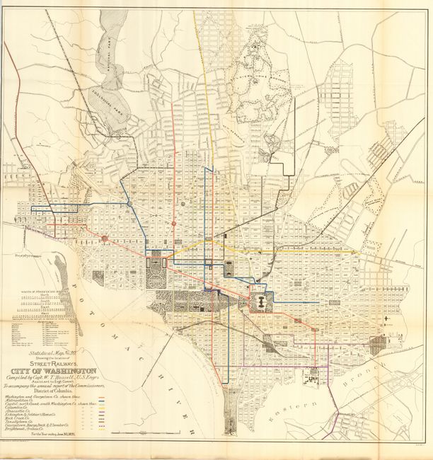
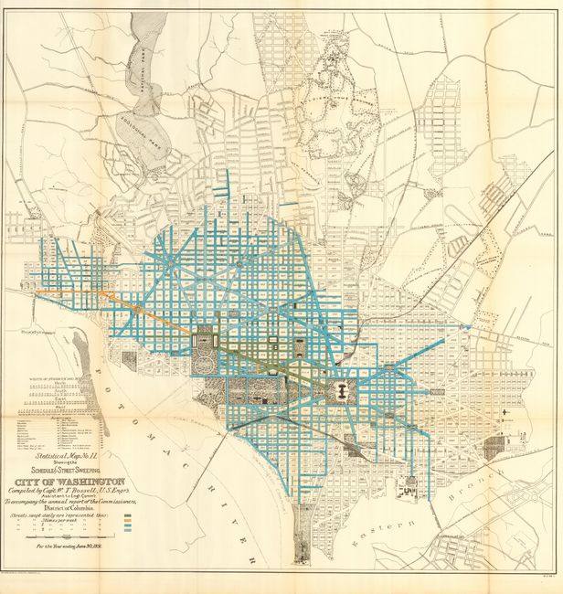
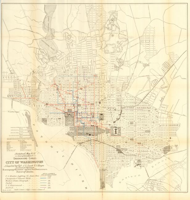
Complete set of twelve maps published to show the large-scale improvements in the infrastructure of the city since the Greene maps of 1880. These maps were prepared by Capt. W.T. Rossell of the Army's Corps of Engineers to accompany the annual report of the Commissioners, District of Columbia. Each map carries the title "Statistical Map No.__", and is drawn on identical scale and shows the street pattern of Washington. Each has a specialized focus, e.g. valuation of real estate, street grade, varieties of street pavements, shade trees, sewers, water supply and distribution, street lamps, public schools, police and fire department stations, street railways, scheduled street sweeping, and underground cables. Some with extensive color. This complete set of 12 matched maps provides a remarkable look into the capital's infrastructure in 1891.
References:
Condition: A
All folding, as issued. Generally all are very good with occasional light fold toning and fold intersection splits.