Subject: World
Period: 1660 (dated)
Publication:
Color: Hand Color
Size:
21.8 x 17 inches
55.4 x 43.2 cm
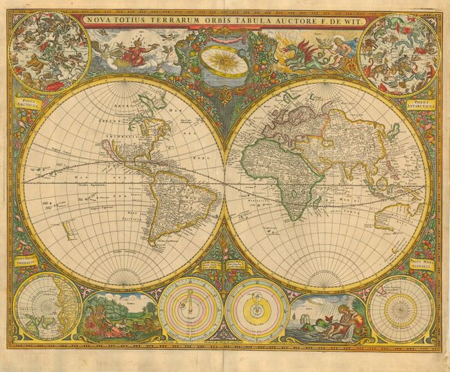
This is Frederick de Wit's scarce and highly desirable first world map that was created for Hendrick Doncker's sea atlas. Cartographically based on Bleau's classic wall map of 1648 updated to delete the large lake at the head of the St. Lawrence River, a revision of the northeast coast of Asia, and the elimination of the land of Yedso above Japan. California is presented as an island with a flat northern coast and no coastline depicted above it. Two celestial spheres fill the upper corners with polar projections displayed in the bottom corners. At bottom center are two astronomical diagrams depicting the solar system theories of Ptolemy and Copernicus. Four beautifully engraved vignettes envelope representations of Air, Fire, Earth and Water and elaborate hanging garlands of flowers and fruit fill in the gaps.
References: Shirley #421.
Condition: B
Good impression with old color, printed on thick paper. Couple of printer's creases near centerfold. Tissue repairs on centerfold and some short tears in blank margins.