Subject: Colorado
Period: 1862 (dated)
Publication: HR Ex. Doc. No. 1, 37th Cong., 3rd Sess.
Color: Black & White
Size:
22 x 16.3 inches
55.9 x 41.4 cm
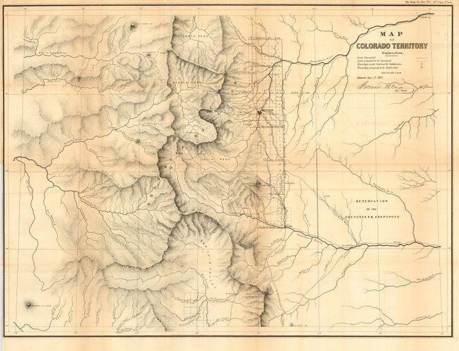
A very early map of Colorado that is signed in the plate "Denver: Sept. 1st 1862. Francis M. Case Sur. Genl." The map carries excellent detail as it is drawn on a scale of 18 miles per inch. Details include watershed, mountains in hachure, and survey status shown along the plains just east of the Front Range. Locates the towns of Denver (with a miniature street plan), Colorado City (Colorado Springs), Boulder City, Golden City, Pueblo, Idaho, Empire, Centre City, Ft. St. Vrain, and more. Locates and names Pike's Peak, Elk Head Mt., Longs Peak, the Spanish Peaks, etc. The map is centered on the San Luis Valley and the parks - South, Middle and North. In the plains is the undefined Reservation of the Cheyennes & Araphoes. Park had issued in the previous year a commercial map of the same area with a slightly different title.
References:
Condition: B
Folding, as issued. Toned along folds, and some light offsetting. Close at binding trim, as issued.