Subject: Southwestern United States
Period: 1856 (published)
Publication: Atlas of the World
Color: Hand Color
Size:
15.5 x 12.8 inches
39.4 x 32.5 cm
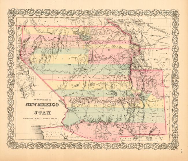
A very interesting map depicting the region with the largest extents of Utah and New Mexico Territories. Utah Territory encompasses all of today's Nevada and extends west to the Continental Divide into present-day northern Colorado. Fillmore City is shown at the capital of Utah. New Mexico Territory includes part of southern Colorado and stretches west to include Arizona and the southern tip of present-day Nevada. It locates Fremont's routes, the proposed routes for the Pacific Railroad, the Spanish Trail, and much more. A fine example of a very desirable map that Wheat found important enough to use as the frontispiece to Volume 4 of his Mapping the Trans-Mississippi West. Decorative scroll border.
References: Wheat (TMW) #832 (frontispiece); Phillips & LeGear #816, 6116, 6125.
Condition: A
Great impression and coloring. Full margins with some toning and a few edge tears or cracks. Paper is brittle just at edge, while the rest is supple and flexible. Map image is fine.