Catalog Archive
Auction 114, Lot 192

"Map Showing the present Wheat growing area in the Basin of the Upper Columbia River", U.S. Government

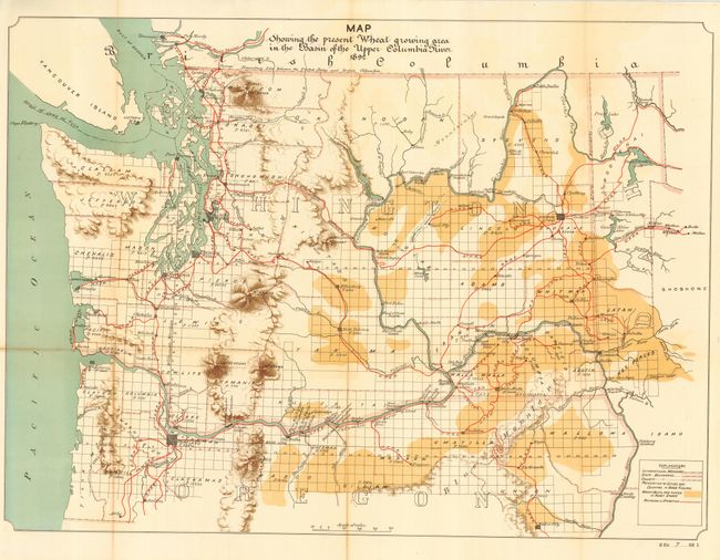
Subject: Washington and Oregon

Period: 1892 (dated)

Publication: Sen. Ex Doc 7, 53rd Cong., 1st Sess.

Color: Printed Color

Size:
29.5 x 21.8 inches
74.9 x 55.4 cm
Download High Resolution Image
(or just click on image to launch the Zoom viewer)

A large and colorful map of the entire state of Washington and the northern part of Oregon illustrating the extent of wheat regions shown through the use of a lovely burnt umber coloring, as noted in the legend. Also details railroads in red, and water in green. Railroads are numerous and all named. Map extends to include northern Oregon south to Baker City. Map includes populations of counties and cities and the extent of public survey. Large and colorful map with good detail drawn on a scale of 1" = 15 miles.

References:

Condition: B

Issued folding, now pressed and backed with archival tissue. A near fine example less toning along some folds.

Estimate: $80 - $100

Sold for: $130

Closed on 3/1/2006

Archived