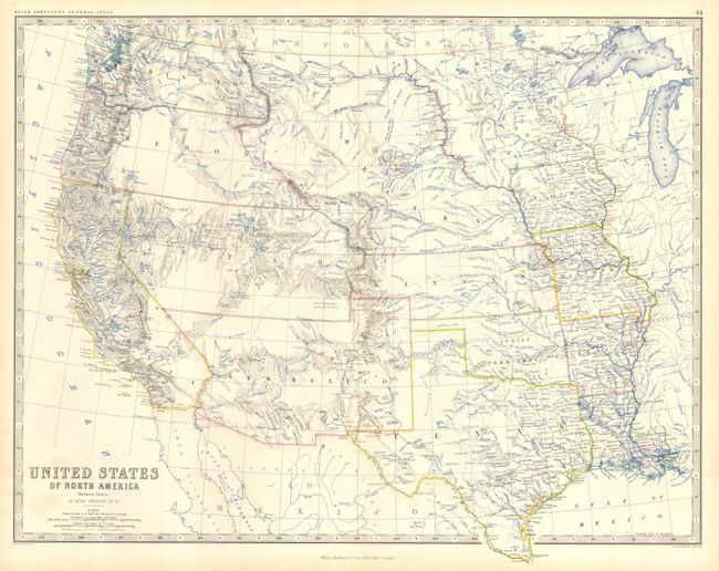
Subject: Western United States
Period: 1861 (circa)
Publication: General Atlas
Color: Hand Color
Size:
22.7 x 17.3 inches
57.7 x 43.9 cm
A terrific map of the western states and territories west of the Mississippi River. Shows a pivotal and fascinating period in America's westward expansion and state development. The entire northwest is occupied by Washington and Oregon as they extend to the Rocky Mountains at the Continental Divide where they are bordered by Nebraska. The large territory of New Mexico includes all of Arizona, and part of Nevada and Colorado, all not yet formed. A huge Utah Territory is bounded in the east by Nebraska and Kansas, and to California in the west. A huge territory of Nebraska extends from its present border with Kansas to the northern border of the United States, the Continental Divide in the west and the Missouri River in the east. Kansas has an extended panhandle that reaches into part of today's Colorado. Minnesota shows its early boundaries as it extends west to the Missouri River and Nebraska Territory. Okalahoma is Indian Territory.
References:
Condition: A
Beautiful example with crisp impression, fine coloring and full margins. Short tear in lower margin that just touches border, closed on verso with archival tape, otherwise a fine example with no flaws.