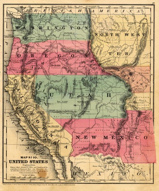
Subject: Western United States
Period: 1853 (dated)
Publication: Smith's Quarto Geography
Color: Hand Color
Size:
8.6 x 10.3 inches
21.8 x 26.2 cm
A very nice map of the West with early territorial boundaries. New Mexico Territory is shown with the pre-Gadsden Purchase border plus the northern extension into today's Colorado. Oregon and Washington extend to the Continental Divide and a huge North West Territory occupies the area to the east with a small area northeast of Utah labeled Nebraska. The large Utah Territory extends to California and to the Continental Divide in today's Colorado and touches a small portion of Indian Territory, which is unnamed here. States/territories are labeled with their population: Utah 11,000, New Mexico 62,000, Oregon 13,000, California 264,000; prominent city populations are also noted. Locates numerous Indian tribes and military forts.
References:
Condition: B
Beautiful impression and coloring. One circular stain below title and a hint of surface soil at lower right, else fine.