Subject: Western United States
Period: 1846 (dated)
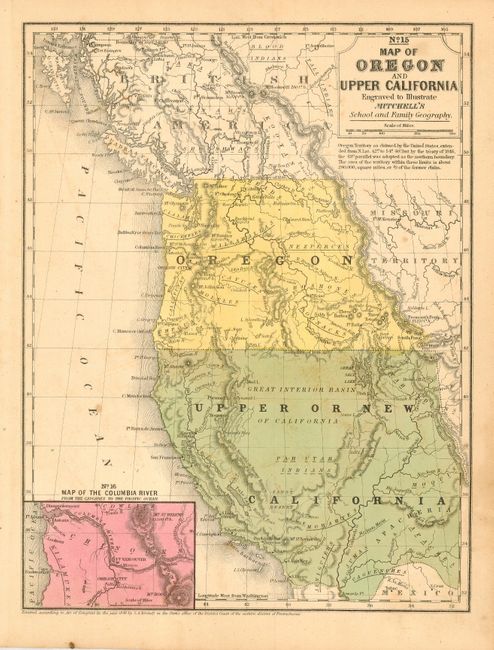
Publication: Mitchell's School Atlas…
Color: Hand Color
Size:
8 x 10.4 inches
20.3 x 26.4 cm
This is the smaller school atlas version of the famous map based largely on Fremont's map of 1845. Inset "Map of the Columbia River from the Cascades to the Pacific Ocean." Upper California extends eastward to the Rio Grande and Oregon Territory extends to the Continental Divide. Shows the Oregon Route in good detail as it winds from the Sweetwater River and through South Pass as it leads to Oregon City. Numerous Indian tribes and villages noted, forts and much more. An early depiction of the Great Interior Basin of California with the Sandy Desert below. The boundary between the United States and Canada is at the 49th parallel; the boundary with Mexico is along the Gila River.
References: Wheat (Gold) #28.
Condition: B
Better than average original coloring. A little scattered light foxing or soiling, else very good.