Subject: United States - Southeast
Period: 1866 (published)
Publication: Foster's Report to the Committee on the Conduct of the War
Color: Black & White
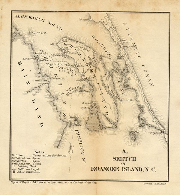
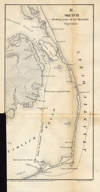
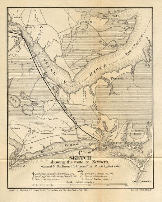
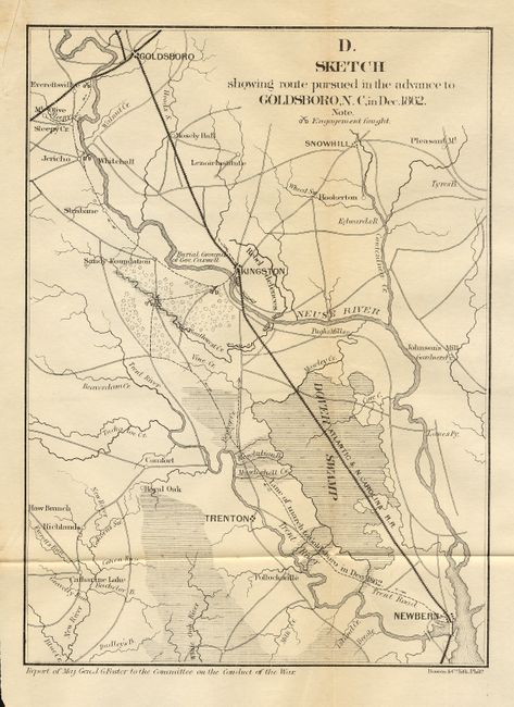
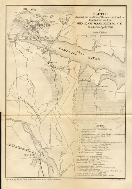
Lot of five matching Civil War maps that accompanied Maj. Gen. J.G. Foster's report. 1) A. Sketch of Roanoke Island, N. C. (6.7x 7"). 2) B. Sketch showing route of the Burnside Expedition (6.2 x 12.2"). 3) C. Sketch showing the route to Newbern, pursued by the Burnside Expedition, March 13, & 14, 1862 (6.8 x 8.5"). 4) D. Sketch showing route pursued in the advance to Goldsboro, N. C. in Dec. 1862 (7 x 9.5"). 5) E. Sketch showing the position of the attacking and defending forces at the Siege of Washington D. C., March 29 to April 16, 1863 (8.3 x 11.8").
References: Stephenson 317.1.
Condition: B
Occasional scattered foxing or light toning on most. The last (Siege of Washington D.C.) is very good. The second map is trimmed at binding trim into image, as issued.