Subject: United States - Southern
Period: 1860 (dated)
Publication: New General Atlas
Color: Hand Color
Size:
13 x 11.5 inches
33 x 29.2 cm
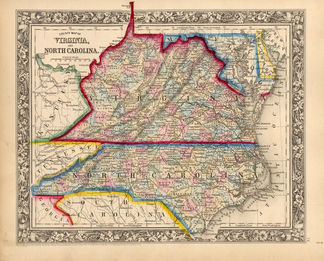
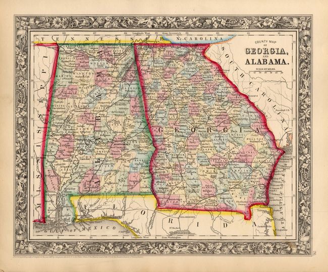
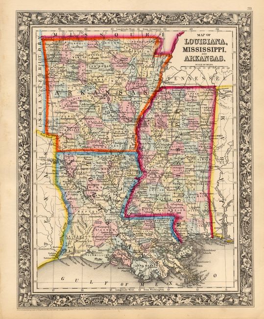
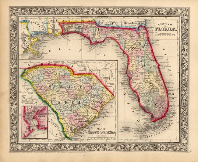
This lot includes five maps that detail eleven southern states on five sheets. These are a matching set from the first edition of the New General Atlas. 1) "County Map of Virginia, and North Carolina" also includes Maryland and most of Delaware. It shows Virginia prior to the separation of West Virginia. 2) "County Map of Kentucky, and Tennessee" is a beautifully engraved map of the states that also shows parts of Illinois, Indiana, Ohio, Mississippi, Alabama, Virginia, North and South Carolina, and Georgia. 3) "County Map of Georgia, and Alabama" shows the extent of early railroads and includes portions of South Carolina and the Florida panhandle. 4) "Map of Louisiana, Mississippi, and Arkansas" shows the region in good detail. 5) "County Map of Florida" details the degree of settlement and development. Large inset is a "Map of South Carolina" and a smaller inset is a "Map of Charleston Harbor." Each map features the beautiful floral borders, fine detail and strong color characteristic of the first edition. All are very well detailed with scores of place names, roads, lakes, rivers, and political divisions. Dimensions are approximate for each map.
References:
Condition: A
Beautiful impression and color with original margins. A couple corners dog-erred, and a little soiling in margins, map images are fine.