Subject: Canada
Period: 1860 (dated)
Publication: New General Atlas
Color: Hand Color
Size:
13 x 10.6 inches
33 x 26.9 cm
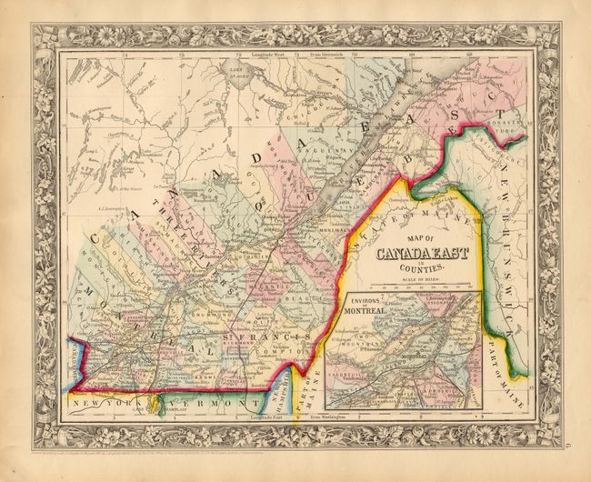
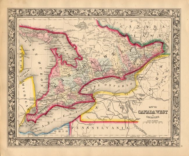
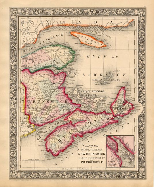
This lot includes a matching set of the three maps related to Canada. 1) "Map of Canada East in Counties" details the St. Lawrence waterway from the mouth to Quebec and west to beyond Montreal where it joins Canada West. Features an inset "Environs of Montreal." 2) "Map of Canada West in Counties" continues west to show Lake Ontario, Lake Erie, Lake St. Clair and Lake Huron. 3) "County Map of Nova Scotia New Brunswick Cape Brenton Id. and Pr. Edwards Id." details the Maritime provinces, the mouth of the St. Lawrence, Anticosti Island, the Bay of Fundy, etc. Inset "City and Harbor of Halifax." Each map features the beautifully engraved floral borders, fine detail and strong color characteristic of the first edition of the New General Atlas. All are very well detailed with scores of place names, wagon roads, lakes, rivers, and political divisions. Dimensions are approximate for each map.
References:
Condition: A+
Original hand coloring and crisp impression with original margins. Lovely even ivory age toning.