Catalog Archive
Auction 114, Lot 107

"The Coast of Newfoundland from Placencia to Cape Bonavista", Cutler, Nathaniel

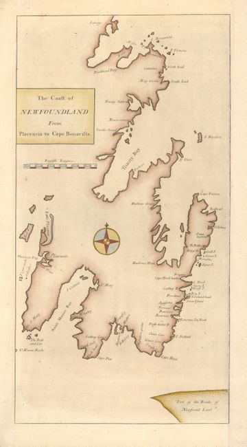
Subject: Canada, Newfoundland

Period: 1728 (circa)

Publication: Atlas Maritimus & Commercialis

Color: Hand Color

Size:
9.5 x 18 inches
24.1 x 45.7 cm
Download High Resolution Image
(or just click on image to launch the Zoom viewer)

Uncommon chart of the British settlements on the east coast of the Avalon Peninsula with good coastal detail. The chart is centered on a large compass rose. This chart has been trimmed from a folio sheet that originally included other maps. The Atlas Maritimus was published anonymously, but it is thought to have been the work of John Senex, John Harris and Henry Wilson.

References: Kershaw #513; Phillips (A) #3298-50.

Condition: B

Trimmed at right with margin added and facsimile of neatline. Repaired 1.5" tear affecting scale and a tiny hole infilled.

Estimate: $200 - $240

Sold for: $150

Closed on 3/1/2006

Archived