Subject: North America
Period: 1850 (circa)
Publication: Atlas National Illustre
Color: Hand Color
Size:
17 x 11.2 inches
43.2 x 28.4 cm
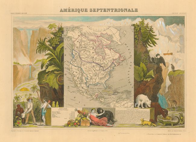
Victor Levasseur's "Atlas National Illustre" and "Atlas Universel Illustre" are among the last decorative atlases published. The maps are all lavishly illustrated with scenes of the countryside, products and activities indigenous to the region.
An nice example of this lovely map with the United States extending into present-day Canada, Russia in control of Alaska, and Mexico's northern border according to the Treaty of 1819 (mislabeld 1810) and including all California and the Southwest. Texas is named and appears to be included in the United States. Surrounded by beautifully engraved scenes of North and Central America including local animals, a ship stranded in the polar sea, and a Mayan Temple. The vignettes are colored in a lovely hand with modern color.
References:
Condition: A
Fine impression on paper with an even ivory toned patina. Full, wide margins.