Subject: Colonial North America and Caribbean
Period: 1725 (circa)
Publication:
Color: Hand Color
Size:
22 x 18.5 inches
55.9 x 47 cm
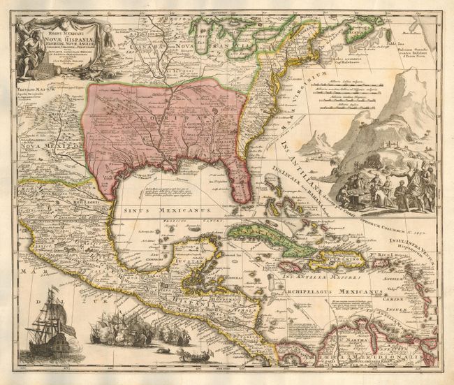
A superb map covering the region from the Great Lakes and Nova Scotia through Central America and Venezuela, and from present day Arizona to the eastern seaboard. The map is based largely on Delisle's map of 1703. The British colonies are shown confined east of the Appalachians. The map itself is filled with settlement place names, Indian tribes and villages, and sea routes from Vera Cruz and Cartagena to Havana and Spain are outlined. It is richly embellished with a fine title cartouche depicting two native figures and symbols of America's natural resources. In the Atlantic is a large engraved scene of extensive gold mining operations with Indians bringing their treasures to fill the European's chest. Off the Pacific coast of Mexico is yet another opulent engraving of a raging sea battle between many ships.
References: Van Ermen p.42; cf Cumming (SE) #137; Manasek #72; Martin & Martin plt.17.
Condition: B
Beautiful impression & original color. Trimmed to neatline & laid on a period-correct sheet to extend margins, likely for inclusion in a composite atlas. Part of neatline in facsimile at top & left. A little light scattered foxing, else fine.