Subject: North Pacific Ocean
Period: 1794 (published)
Publication: Voyages de la Chine
Color: Hand Color
Size:
22.5 x 17.3 inches
57.2 x 43.9 cm
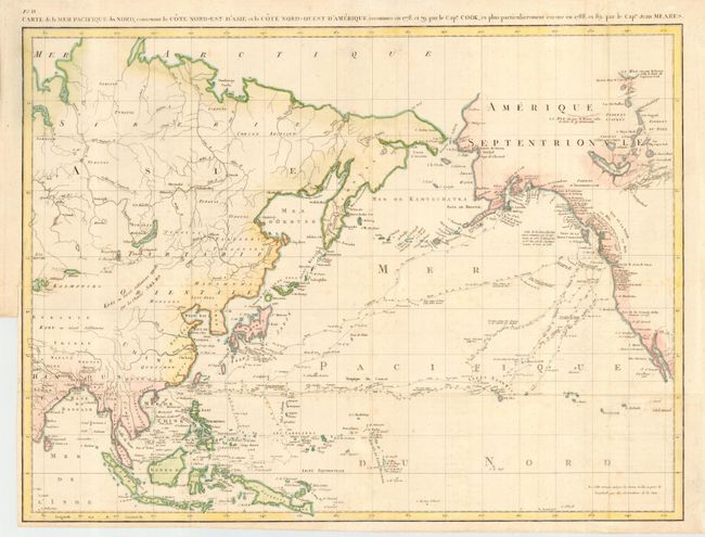
Great map of the North Pacific detailing the explorations of the Captain John Meares. The map covers a good portion of the Asian and North American continents, but the primary focus is on the tracks of the various explorers through the Northwest, Alaska, Canada, Hawaii and through the Pacific to the Philippines and Southeast Asia. Meares is one of the more colorful figures in the early European exploration of the Northwest coast and Alaska. He claimed many of the discoveries of others as his own and rekindled the idea of the Sea of the West and a Northwest Passage. His mythical inland sea appears stretching from the Strait of Juan de Fuca northwards to just north of the Queen Charlotte Islands. A note indicates that the American sloop Lady Washington captained by Robert Gray had explored this sea in 1789. This was a complete fabrication on the part of Meares; nevertheless it gave new credence to the idea and appears on several later maps as well.
References: Hayes pp. 59-61; Kershaw #1172; Wagner #759.
Condition: B
Issued folded, now pressed. Normal binding trim at left with adequate margin for framing. Bit of faint foxing.