Catalog Archive
Auction 113, Lot 719

"Formosa Island and the Pescadores, China", U.S. Government
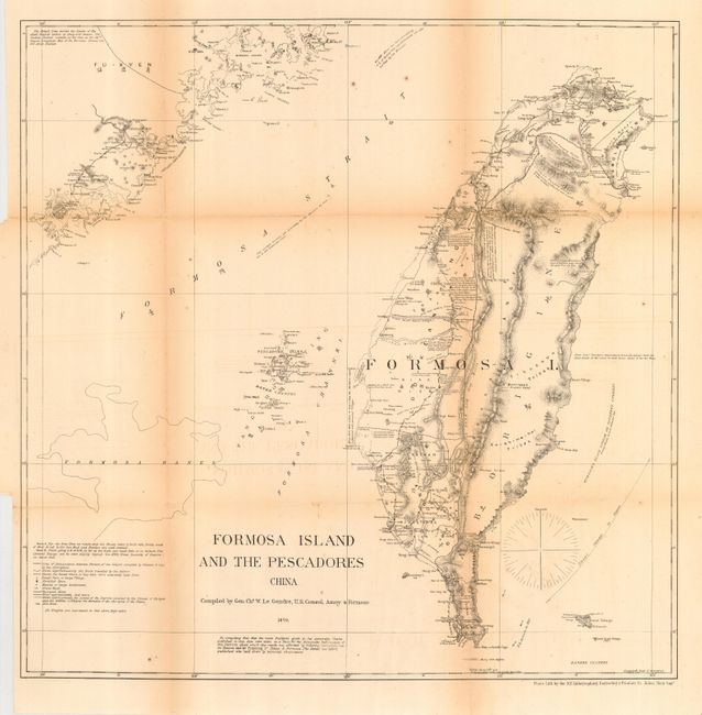
Subject: Taiwan

Period: 1870 (dated)

Publication: A report on the commercial relations of the United States and foreign nations…

Color: Black & White

Size:
19.8 x 19.8 inches
50.3 x 50.3 cm
Download High Resolution Image
(or just click on image to launch the Zoom viewer)

Uncommon chart showing the island of Taiwan with good detail. Political regions are named in English and with Chinese characters and agricultural areas, towns, roads, and topography are shown. Interesting place names include Bantan Tribes, Bootang Tribes, Confederation of 18 Tribes Under One Chief, etc. Includes portion of mainland China named Fu-Kyen. The map was compiled by Gen. Chs. W. LeGendre, U.S. Consul, Amoy & Formosa. LeGendre was French born, but distinguished himself in the U.S. Army during the Civil War. An interesting biography can be found here. Note indicates that observations by Commander Brookers suggests the east coast of Formosa is laid down about 3' too far west.

References:

Condition: B

Issued folding, now pressed and backed with archival tissue. Toning along some folds.

Estimate: $120 - $160

Sold for: $350

Closed on 12/7/2005

Archived