Catalog Archive
Auction 113, Lot 694

"An Accurate Map of the Holy Land", Bowen, Emanuel
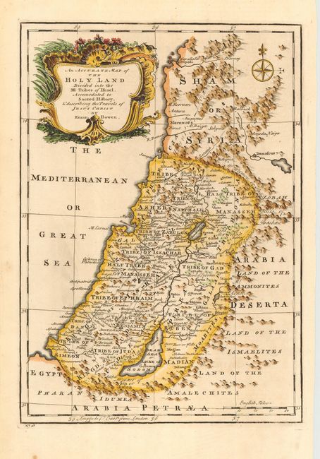
Subject: Holy Land

Period: 1757 (circa)

Publication: A Complete System of Geography

Color: Hand Color

Size:
9 x 12.5 inches
22.9 x 31.8 cm
Download High Resolution Image
(or just click on image to launch the Zoom viewer)

A beautiful copper engraved map of the Holy Land including part of Syria from Tripoli down to Gaza on the Mediterranean coast. Shows tribal areas including the Ammonites, Israelites & Amalekites along the east. Attractive cartouche with shell, leaf, flower and scroll motifs. Compass rose with fleur-de-lys.

References: Laor #126

Condition: A

Dark, crisp impression on fine hand laid paper. Hint of soil or light ink in Mediterranean, else fine.

Estimate: $120 - $140

Sold for: $160

Closed on 12/7/2005

Archived